We occasionally utilize the automated electron image mosaic function in Thermo NSS and Pathfinder to make large maps of say a whole thin section. But every once in a while we notice that the images are not being properly tiled.
This morning Julie Chouinard was getting ready to acquire some large area mosaic images and she noticed that the software (Pathfinder 1.4) was tiling the images so that the upper right image was in the lower left. In other words the X and Y axis orientations were flipped.
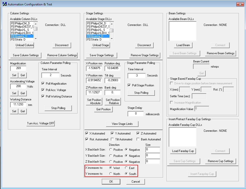
So we went into the AutomationClient where the stage polarities are specified and saw that they looked correct in that the direction of increasing X was "East" and the direction of increasing Y was "North". That's cartesian coordinates and that's what the FEI stages are.
So just on a whim I said let's just swap those directions and see what we get, and lo and behold the tiling is now correct. But can someone explain why we have to specify that the stage has increasing X to the "West" and increasing Y to the "South" as seen here:


 Welcome to the Probe Software forum area!